Fantasy maps show worlds that don’t exist, yet looking at them feels magical. You see them in books like Tolkien’s novels and in video games. They have sparked people’s imaginations for a long time.
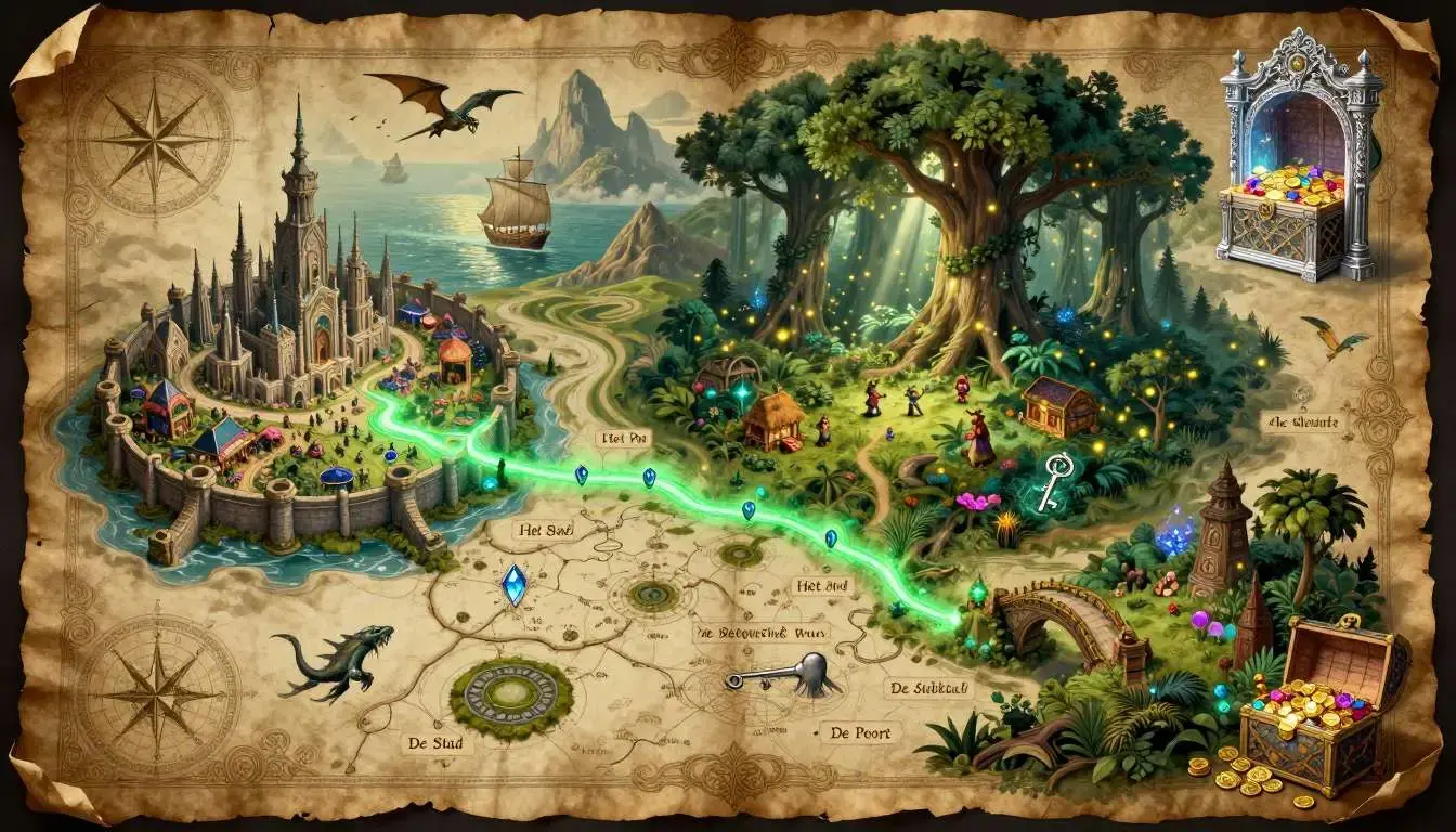
People make fantasy maps for many reasons. Writers use them to keep story worlds consistent. Game masters use them for Dungeons & Dragons campaigns. Video game designers use them to plan games. Artists sell them as prints. Some people simply make them for fun because creating a world feels deeply satisfying.
You can draw fantasy maps with pencil and paper, paint them with watercolours, or use computer programs like Photoshop or free tools like GIMP. You can also use a fantasy map generator or fantasy map creator powered by AI to create maps from your descriptions.
This guide will teach you everything step by step. You will learn the basic parts of a fantasy map, how to draw landmasses, mountains, rivers, and cities, as well as different methods and tools. You will also discover design tips to make your fantasy maps better.
What is a Fantasy Map?
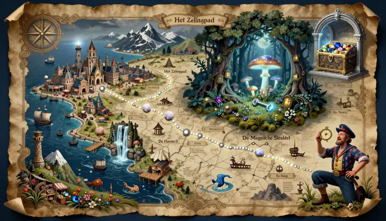
A fantasy map is a visual diagram or sketch of an imaginary world, typically containing landmasses, terrain features, settlements, and points of interest that exist only in fiction. Unlike real-world cartography, fantasy mapmaking is not bound by actual geography—you can include floating islands, impossible mountain ranges, or cities perched on volcano sides.
Fantasy maps typically include several key components: coastlines and landmasses that define the world’s shape, mountain ranges and terrain that create natural barriers, rivers and lakes that carve through the landscape, forests and deserts that establish climate zones, cities and settlements where inhabitants live, roads and trade routes that connect civilisations, and political borders that mark territorial divisions. Many also feature decorative elements like compass roses, scale bars, legends, and illustrated borders that give them an authentic cartographic feel.
These maps serve practical purposes across creative industries. Novelists use them to maintain consistency when characters travel across their fictional worlds. Tabletop gamers rely on them to visualise adventures and plan tactical encounters. Video game developers use them during production to design playable spaces and later as marketing materials. Artists create them as standalone artwork for collectors and fans. The scale can range from an entire planet down to a single dungeon chamber, depending on what the project requires.
Why Do People Create Fantasy Maps?
People create fantasy maps for dozens of reasons, and your purpose will shape every decision you make.
Writing and Worldbuilding
Authors use maps to keep their fictional worlds consistent. When your hero travels from eastern forests to the capital, you need to know the journey time and terrain. A map prevents mistakes and helps readers picture the story setting. Many readers flip back to the map while reading, tracing character journeys across the landscape.
Tabletop Gaming
Dungeons & Dragons players and game masters have driven a huge resurgence in fantasy cartography. A good DnD map maker turns descriptions into places players can explore. Regional maps help players plan adventures, while battle maps provide tactical terrain for combat. The tabletop gaming community has created a whole ecosystem of RPG map makers, tools, and resources.
Video Games
Game developers use fantasy maps during planning and marketing. Concept artists sketch world maps to set the game’s visual style, and level designers use detailed maps to plan player progression. Published maps often become collectibles—think of the cloth maps that came with classic Ultima games or the detailed atlases included with Elder Scrolls titles.
Art and Commerce
Fantasy cartography has become a real art form with a thriving market. Artists sell prints, commissions, and digital assets on platforms like Etsy and Patreon, which support hundreds of professional fantasy map makers. Some artists specialise in asset packs—collections of mountains, trees, and buildings that other creators can use in their own maps.
Pure Creative Enjoyment
Sometimes people create fantasy maps simply because it’s fun. There is a meditative quality to drawing coastlines and placing mountains as you watch a world emerge from nothing. Many mapmakers say the process feels deeply satisfying because it combines art with puzzle-solving—you work out how rivers flow and where civilisations would grow.
Elements of a Fantasy Map
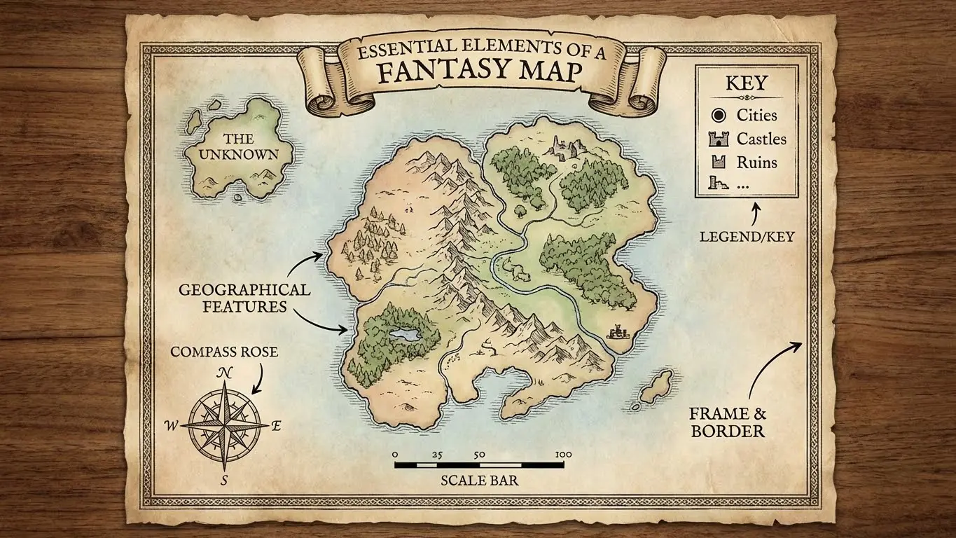
Before you start drawing, it helps to understand the building blocks in greater detail. You don’t need every element in every map, but knowing your options helps you make smart choices.
Landmasses and Coastlines
The shape of your continents and islands forms the foundation. Interesting coastlines have bays, peninsulas, and archipelagos, which create visual interest and suggest harbours, naval routes, and isolated communities. Avoid perfectly smooth edges—real coastlines are complex and irregular, shaped by erosion and tectonic activity over millennia.
Mountains and Terrain
Mountain ranges define regions, create natural borders, and influence weather patterns. In the real world, mountains typically form in chains along tectonic boundaries where plates have collided, rather than appearing in random clusters. Your fantasy world can break these rules, but understanding them helps you create believable geography. Hills, plateaus, and valleys add variety to your terrain.
Rivers and Water Features
Rivers flow downhill from mountains to seas and grow larger as tributaries join them. One common mistake is drawing rivers that split as they flow toward the ocean; in reality, rivers merge rather than divide. Deltas at river mouths are the exception. Lakes form in depressions and are often fed by mountain runoff, while swamps develop in low-lying areas with poor drainage.
Forests and Vegetation
Forests don’t appear randomly—they grow where conditions support them. Consider rainfall patterns, which are influenced by mountains and winds. The rain shadow effect means one side of a mountain range might be lush while the other side remains dry. Different forest types can suggest climate zones and add visual variety to your map.
Cities and Settlements
Settlements develop where resources exist. Cities grow at river crossings, natural harbours, and strategic passes. Mining towns appear near ore deposits, and farming communities settle in fertile valleys. Think about why people would choose each location—capital cities often sit at the heart of their kingdoms, accessible by major roads or rivers.
Roads and Routes
Trade routes connect economic centres and follow the easiest terrain whenever possible. Roads avoid mountains unless passes make crossing worthwhile, and ancient paths might follow rivers or coastlines. Bridges, ferries, and mountain passes become strategically important, often attracting settlements or fortifications.
Political Boundaries
Borders between kingdoms often follow natural features such as mountain ranges, rivers, and coastlines, which make defensible boundaries. Straight-line borders usually suggest recent colonial division of territory. Disputed regions, buffer states, and enclaves add political complexity that can drive stories and conflicts.
Legends, Compass Roses, and Scale
Cartographic elements help readers understand your map. A legend explains your symbols, showing icons for cities of different sizes, ruins, points of interest, and terrain features. A compass rose shows direction, and a scale bar gives readers a sense of distance. These elements also contribute to your map’s visual style.
How to Create a Fantasy Map: Methods and Approaches
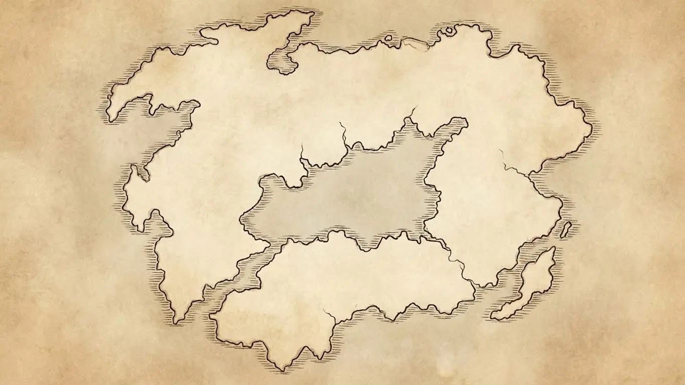
There is no single correct way to create a fantasy map. Your approach depends on your skills, tools, intended use, and personal preferences.
Traditional Pencil and Paper
Hand-drawing remains the easiest way to start since you only need paper and something to draw with. Many professional mapmakers still sketch initial concepts by hand before moving to digital tools.
Start with light pencil sketches and establish your landmasses first without worrying about details yet—focus on overall shape and balance. Once you’re happy with the basic layout, add terrain features, starting with mountains and then working down to smaller details. Many artists use fine-tipped pens for final linework and erase pencil marks once the ink dries.
For a more polished look, use different pen weights: thicker lines for coastlines and political borders, and finer lines for terrain details. Stippling—patterns of dots—can suggest terrain types or add shading, while cross-hatching creates texture and depth. With practice, hand-drawn maps develop a distinctive character.
Painted Fantasy Maps
Watercolours and acrylics allow for rich, colourful maps that appeal to collectors. Painted maps work well as standalone art or book covers, with the medium suiting atmospheric, impressionistic interpretations.
Watercolour maps often feature subtle colour gradations—ocean blues deepen away from shore, and terrain colours suggest climate zones. Watercolour is unpredictable, which can create happy accidents that add organic character. Acrylic paints offer more control and vibrant colours but require different techniques.
For historical aesthetics, try tea-staining or coffee-staining paper to create an aged parchment effect. Careful burning of edges can enhance this antique look, though you should use safety precautions. These techniques work well for prop maps in films or live-action roleplay events.
Digital Map Making Software
Digital tools have transformed fantasy cartography by offering precision and flexibility with capabilities impossible in traditional media. Your software choice depends on your goals and technical comfort.
Adobe Photoshop remains the industry standard for digital illustration. Its layer system allows non-destructive editing, and custom brushes can replicate hand-drawn textures. Many professionals create and sell Photoshop brush packs for cartography, including mountain symbols, tree clusters, compass roses, and decorative borders.
GIMP offers similar capabilities to Photoshop without the subscription cost. As free, open-source software, it’s an excellent choice for beginners. The learning curve is steeper than some alternatives, but extensive online tutorials can help.
Procreate has become very popular among iPad users. Its intuitive interface and natural brush feel appeal to artists moving from traditional media. The app’s time-lapse recording feature lets you create process videos of your mapmaking journey.
Inkarnate was designed specifically as a fantasy map maker. Its browser-based interface provides drag-and-drop assets, including mountains, forests, cities, and decorative elements that snap together into professional-looking maps. The tool suits users who want polished results without building illustration skills from scratch.
Wonderdraft is another dedicated fantasy map creator application with a one-time purchase price. It excels at creating regional and world maps with consistent styles. The software includes built-in assets and supports custom assets, making it extensible as your needs grow.
AI for Creating Fantasy Maps
Artificial intelligence has opened new possibilities for fantasy mapmaking. AI tools can generate unique map concepts in seconds, providing inspiration or finished products. This technology helps people who have vivid ideas but lack traditional artistic skills.
One excellent free resource is the AI Fantasy Map Generator at AIFreeForever. This fantasy map generator lets you describe the map you want—perhaps a volcanic archipelago with ancient ruins or a frozen northern kingdom. The tool generates unique visuals based on your description. The results can serve as finished maps for personal projects or as starting points for further refinement.
If you want ready-made fantasy map images with specific styles, you can explore the Fantasy Map AI Image Prompts collection. This resource provides downloadable fantasy maps and prompt ideas that can help you generate exactly the style you envision.
AI-generated maps work well for quick visualisations during brainstorming, creating mood boards for larger projects, generating maps for personal tabletop campaigns, and producing social media content or blog illustrations. Many creators use AI to generate initial concepts, then refine the results using traditional digital tools.
How to Design a Fantasy Map
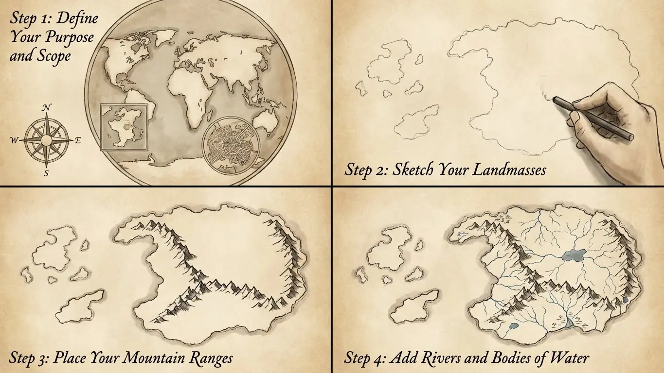
Regardless of your tools, the basic process follows similar stages. Here is a workflow that works for both beginners and professionals learning how to make a fantasy map.
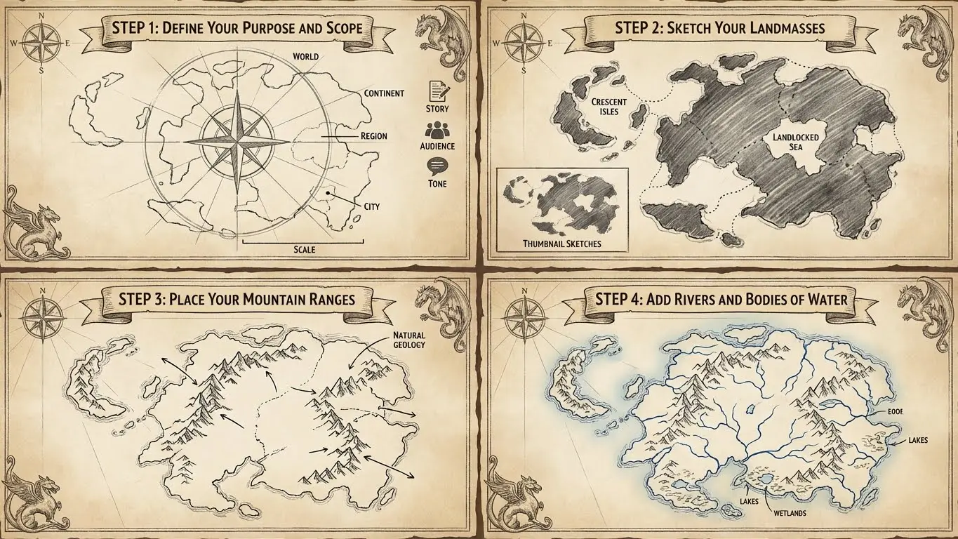
Step 1: Define Your Purpose and Scope
Before you draw, clarify what you’re creating and why. What story does this map need to tell? What scale are you using—a world, a continent, a region, or a city? Who is the audience? A map for your own reference can be rough, while a map you plan to publish should be polished.
Consider the tone and genre of your world. A grimdark setting might need harsh, angular landmasses with ominous place names, while a whimsical fairy tale world might feature rounder, friendlier shapes. Your map’s visual style should match its narrative context.
Step 2: Sketch Your Landmasses
Start loose and rough. Many mapmakers begin by scribbling random shapes and then developing promising ones into continents. Others start with a specific vision—perhaps a crescent-shaped island chain or a landlocked sea surrounded by hostile nations.
Think about composition and visual balance. Major landmasses shouldn’t all cluster in one area unless that serves your world’s story. Consider negative space too—the oceans and seas are as important as the land. Experiment with thumbnail sketches before committing to a final layout.
Step 3: Place Your Mountain Ranges
Mountains are the bones of your landscape. They determine where rivers flow, where forests grow, and where civilisations develop. Place major ranges first and think about how they divide your world into regions. Mountains along coastlines create dramatic scenery, while interior ranges can separate nations or cultures.
Avoid scattering mountains randomly unless your world has a magical explanation for unusual geology. Mountain ranges look most natural when they follow linear or curved paths, occasionally branching or converging.
Step 4: Add Rivers and Bodies of Water
Rivers start in highlands and flow to the sea, always seeking the lowest ground. Major rivers typically begin in mountain ranges and gather tributaries as they cross the landscape. Remember: rivers merge—they don’t split. This is the most common geography mistake in fantasy maps.
Add lakes where it makes sense, such as mountain valleys, places where rivers widen, or anywhere with a logical depression. Inland seas can create interesting worldbuilding opportunities. Swamps and wetlands develop in low areas with poor drainage, often appearing near river mouths or in regions with heavy rainfall.
Step 5: Establish Climate Zones and Vegetation
Think about where different environments would logically exist. Deserts often form on the leeward side of mountain ranges, starved of moisture by the rain shadow effect. Tropical rainforests need heat and rainfall, while tundra develops in the far north or south and at high elevations.
Mark forests, grasslands, deserts, and other terrain types using appropriate symbols or colours. These zones don’t need rigid boundaries—in reality, biomes blend into each other gradually. Your map might show distinct regions for clarity or suggest gradual transitions for realism.
Step 6: Place Settlements and Civilisations
Now add the human or non-human element. Major cities need good reasons for their locations: river crossings, natural harbours, fertile farmland, defensible positions, or resource deposits. Capital cities often sit centrally within their territories, and port cities line the coasts and navigable rivers.
Think about settlement density and distribution. Agricultural societies need arable land. Trading cultures cluster along transportation routes. Mining communities appear near ore deposits, and pastoral nomads roam grasslands and steppes. Each culture’s settlements should make sense for their economy and way of life.
Step 7: Draw Roads and Borders
Connect your settlements with roads that follow sensible routes. Trade roads link economic centres, while military roads might be straighter, built for rapid troop movement. Ancient paths often follow rivers or coastlines, and mountain passes become crucial chokepoints.
Political borders can follow natural features or cut arbitrarily across the landscape, depending on your world’s history. Recent conquests might show straight-line borders, while ancient kingdoms often have complex boundaries shaped by generations of treaties and conflicts.
Step 8: Add Labels and Cartographic Elements
Labels bring your map to life. Name your continents, nations, cities, mountains, rivers, and seas. Good fantasy names feel consistent within each culture while varying between different peoples. Consider how names might evolve across linguistic boundaries—the same river might have different names in different countries.
Typography matters enormously. Use larger, decorative fonts for major features and simpler fonts for minor locations. Curve labels to follow coastlines or rivers. Add a compass rose, scale bar, and legend to complete the presentation.
Step 9: Refine and Polish
Step back and evaluate your map as a whole. Does it tell the story you intended? Are there empty areas that need detail or cluttered sections that need simplification? Does the eye flow naturally across the composition?
Add finishing touches such as decorative borders to frame the map or cartouches to hold titles. You might draw sea monsters in the oceans or add ships on trade routes. These embellishments should enhance without overwhelming—the best fantasy maps balance detail with readability and decoration with function.
Design Tips for Better Fantasy Maps

Beyond the technical process, certain design principles can elevate your maps.
Embrace asymmetry. Perfectly symmetrical landmasses feel artificial. Natural coastlines are complex and irregular. Even if gods or magic shaped your world, asymmetry creates visual interest.
Vary your scale of detail. Important regions deserve more detail than peripheral areas. This creates focal points and hierarchy, guiding viewers’ attention to what matters most.
Consider the mapmaker’s perspective. Who supposedly drew this map within your world? A royal cartographer might show favourable borders. A sailor’s chart emphasises harbours and hazards. An explorer’s map might have blank spaces marked “here be dragons.”
Leave room for mystery. You don’t need to detail every corner. Unexplored regions invite imagination, and mysterious islands with cryptic labels leave space for future development.
Study real maps for inspiration. Historical maps, geographic atlases, and satellite imagery can spark ideas. They show you coastlines, terrain patterns, and cartographic styles. The more real maps you study, the more natural your fantasy maps will feel.
Bringing Your Fantasy World to Life
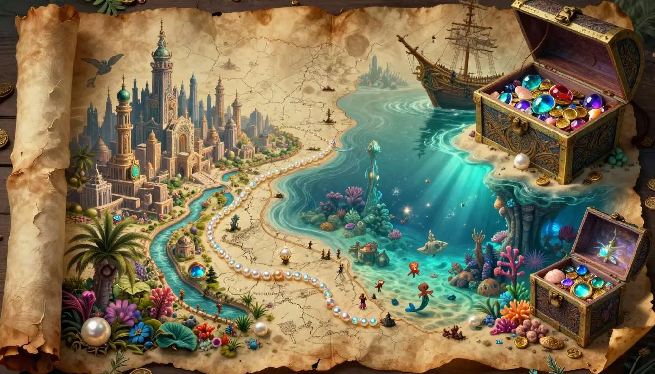
Creating a fantasy map is one of the most rewarding parts of worldbuilding. Whether you sketch with pencil on paper, paint with watercolours, design in professional map making software, or generate concepts with AI tools, the process turns abstract ideas into places that feel real.
Start with simple tools and small projects. Draw a single island, a local region, or a city district. As your confidence grows, expand your scope. Experiment with different styles and methods, and when you want quick inspiration, remember that AI fantasy map generators can spark new ideas whenever you need them. Tools like Azgaar’s Fantasy Map Generator also offer free options for creating detailed worlds.