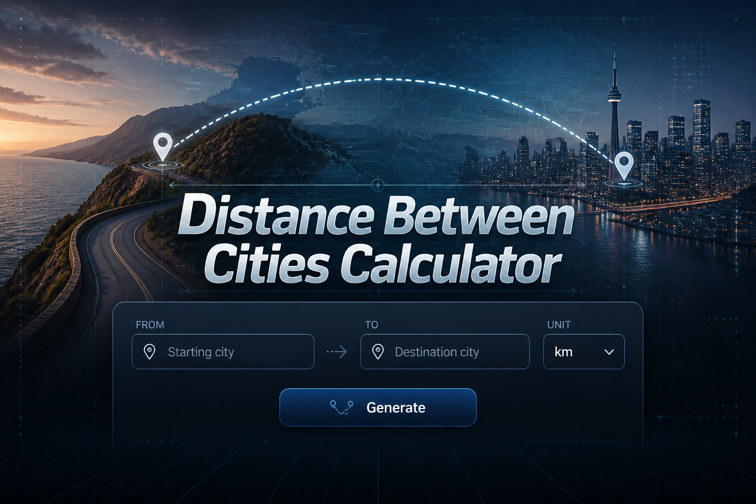
Distance Between Cities Calculator
A distance between cities calculator computes the straight-line distance (as the crow flies) and estimated driving distance between any two cities worldwide. Enter your origin and destination in the panel to get an instant result using the Haversine formula, or ask the AI for detailed route breakdowns, driving times, and travel tips.
What Is a Distance Between Cities Calculator?
A distance between cities calculator is a tool that measures the geographic separation between two locations. It typically returns two values: the straight-line distance (also called "as the crow flies" distance) and the estimated driving distance along actual roads. The straight-line distance is the shortest possible path between two points on the Earth's surface, measured through the air without regard for roads, terrain, or borders. The driving distance accounts for road networks and is always longer than the straight-line figure.
These calculators are widely used for trip planning, freight logistics, relocation decisions, and geographic research. Whether you're comparing travel options or studying geography, understanding the difference between straight-line and driving distances between towns is essential for accurate planning. You can also use our driving distance calculator for more detailed route estimates with AI-powered breakdowns.
How the Distance Calculator Works
Straight-Line (As the Crow Flies) Distance
The straight-line distance is calculated using the Haversine formula, which accounts for the curvature of the Earth. This gives the shortest arc-length distance between two points on a sphere, using their latitude and longitude coordinates. For nearby cities, the straight-line and great-circle distances are nearly identical. For cities on opposite sides of a continent or country, the curvature of the Earth becomes a meaningful factor in the calculation.
Driving Distance Estimate
The estimated driving distance is approximated by multiplying the straight-line distance by a tortuosity factor — typically between 1.2 and 1.4. The exact multiplier varies depending on the terrain, road density, and presence of natural barriers. In flat regions with dense highway networks (like the US Midwest), driving distance is often only 20–25% more than straight-line. In mountainous or rural areas, the multiplier can be 40% or higher. Our calculator uses a conservative 1.3× multiplier as a reasonable average.
The Haversine Formula
The Haversine formula calculates the great-circle distance between two points on a sphere given their longitudes and latitudes. It is the standard method used in navigation and geographic information systems. The formula is:
c = 2 × atan2(√a, √(1−a))
d = R × c
Where R is the Earth's mean radius (6,371 km), lat1 and lat2 are the latitudes of the two points, lon1 and lon2 are their longitudes, and all angles are in radians. The result is the straight-line distance along the Earth's surface.
Straight-Line vs Driving Distance
Straight-line distance and driving distance are almost never the same. Roads must follow existing infrastructure, terrain, property lines, and jurisdictional boundaries. A mountain range between two cities may mean drivers must travel around it entirely, making the driving distance dramatically longer than the straight-line figure. Urban areas with dense street grids come closer to straight-line distances, while rural or mountainous routes can have a driving-to-straight-line ratio of 1.5 or higher.
When planning travel, always use the driving distance rather than the straight-line distance for time and fuel estimates. The straight-line figure is most useful for geographic context — understanding how far two cities are as a geographic reference — while the driving distance is what matters for logistical planning. For detailed route distances and travel converter between cities, use mapping tools or ask our AI chat for specific route data.
Distance Between Major US Cities
| City Pair | Straight-Line Miles | Driving Miles (est.) | Drive Time (est.) |
|---|---|---|---|
| New York → Los Angeles | 2,445 mi | ~2,790 mi | ~40 hrs |
| Chicago → Houston | 940 mi | ~1,090 mi | ~15 hrs |
| Miami → Atlanta | 662 mi | ~660 mi | ~9 hrs |
| Dallas → Denver | 663 mi | ~860 mi | ~12 hrs |
| Seattle → San Francisco | 678 mi | ~808 mi | ~12 hrs |
| Boston → Washington DC | 393 mi | ~439 mi | ~7 hrs |
| Phoenix → Las Vegas | 256 mi | ~295 mi | ~4.5 hrs |
| Minneapolis → Chicago | 355 mi | ~408 mi | ~6.5 hrs |
Straight-line distances calculated using the Haversine formula. Driving estimates are approximate and vary by route.
How to Calculate Distance Using Coordinates
Finding City Coordinates
Every city has a geographic coordinate expressed as latitude (north-south position) and longitude (east-west position). New York City, for example, is at approximately 40.7128°N latitude and 74.0060°W longitude. Los Angeles is at 34.0522°N, 118.2437°W. These coordinates are available from geographic databases, maps, and our built-in city database used in the calculator above. To use the Haversine formula manually, you need the latitude and longitude of both cities in decimal degrees.
The Haversine Formula Explained
The Haversine formula takes four inputs: the latitude and longitude of the origin city and the latitude and longitude of the destination city. All values must be converted from degrees to radians by multiplying by π/180. The formula then computes the angular distance between the two points on the sphere and multiplies by the Earth's radius (6,371 km or 3,959 miles) to get the actual distance. The result is the shortest path along the Earth's curved surface — not through it — which is what makes it useful for real-world navigation.
For very short distances (cities within the same metropolitan area), the Haversine formula gives results nearly identical to flat-earth calculations. For distances across continents, the Earth's curvature becomes significant. A flight from New York to London, for instance, follows a curved great-circle route that appears as a curve on a flat map but is actually the shortest path.
Factors That Affect Travel Distance
Route Choice (Highway vs Scenic)
The route you choose directly affects total travel distance. Interstate highways are engineered for efficiency and often provide the shortest drivable path between two cities, though they may not always pass through the most convenient areas. Scenic routes, state highways, or detours through specific cities can add significant mileage. When using a travel distances calculator, the result typically reflects the most direct highway route, not a scenic or preferred alternative.
Road Conditions and Construction
Road closures, construction detours, and seasonal road restrictions can alter driving distances from the estimated baseline. Mountain passes may be closed during winter months, forcing drivers to take much longer routes around the obstruction. In urban areas, one-way streets and restricted zones can add distance compared to what a straight routing might suggest. Always check current road conditions before a long journey.
State and Country Borders
International borders introduce additional complexity in distance calculations. Border crossing wait times, restricted crossing points, and toll roads all affect practical travel distances between cities in different countries. Some borders only have a limited number of official crossing points, which may require significant detours compared to the straight-line route. For international city distances, the driving estimate may differ substantially from a domestic route of similar straight-line length.
Distance Calculator Examples
Example 1 - New York to Los Angeles
New York City (40.7128°N, 74.0060°W) to Los Angeles (34.0522°N, 118.2437°W). Applying the Haversine formula: Δlat = -6.6606° (−0.1163 rad), Δlon = −44.2377° (−0.7718 rad). Result: approximately 2,445 miles (3,934 km) straight-line. The actual driving distance via I-40 or I-80 is approximately 2,790 miles — about 14% longer — with an estimated drive time of 39–42 hours without stops. This is the longest city-to-city drive commonly made in the continental United States. For context, use our speed calculator to estimate arrival times at different average speeds.
Example 2 - Chicago to Houston
Chicago (41.8781°N, 87.6298°W) to Houston (29.7604°N, 95.3698°W). Straight-line distance using Haversine: approximately 940 miles (1,513 km). Driving distance via I-55 South and I-69 is approximately 1,090 miles, taking around 15 hours at highway speeds. This route passes through St. Louis, Memphis, and Little Rock — all significant cities where traffic delays can add time to the journey. Chicago and Houston are two of the largest metropolitan areas in the US, making this a heavily traveled corridor for both commercial and personal travel.
Example 3 - Miami to Atlanta
Miami (25.7617°N, 80.1918°W) to Atlanta (33.7490°N, 84.3880°W). Straight-line distance: approximately 662 miles (1,066 km). The driving distance via I-75 North is roughly 660–680 miles depending on the exact starting and ending points — unusually close to the straight-line figure because I-75 runs nearly directly between the two cities through flat Florida and Georgia terrain. Drive time is approximately 9 hours. This is one of the highest-traffic interstate corridors in the southeastern United States.
How Far Is It? Popular US City Distances at a Glance
These are among the most frequently searched city-pair distances in the United States. You can calculate any of these instantly using the AI chat panel on the left — just type the two city names and get straight-line distance, estimated driving distance, drive time, and travel tips.
| # | City Pair | Straight-Line | Driving Distance | Drive Time | Main Route |
|---|---|---|---|---|---|
| 1 | Los Angeles → Las Vegas | 229 mi / 369 km | ~270 mi | ~4 hrs | I-15 N |
| 2 | Chicago → New York | 714 mi / 1,149 km | ~790 mi | ~12 hrs | I-80 E / I-90 E |
| 3 | Dallas → Houston | 224 mi / 361 km | ~239 mi | ~3.5 hrs | I-45 S |
| 4 | Seattle → Portland | 157 mi / 253 km | ~179 mi | ~3 hrs | I-5 S |
| 5 | Miami → Orlando | 191 mi / 307 km | ~236 mi | ~3.5 hrs | Florida Tpke / I-95 |
| 6 | Atlanta → Nashville | 215 mi / 346 km | ~249 mi | ~4 hrs | I-24 W / I-75 N |
| 7 | Denver → Salt Lake City | 371 mi / 597 km | ~525 mi | ~7.5 hrs | I-70 W / I-15 N |
| 8 | San Francisco → San Diego | 446 mi / 718 km | ~502 mi | ~7.5 hrs | US-101 S / I-5 S |
| 9 | Philadelphia → Washington DC | 123 mi / 198 km | ~141 mi | ~2.5 hrs | I-95 S / NJ Tpke |
| 10 | Nashville → Memphis | 200 mi / 321 km | ~212 mi | ~3.5 hrs | I-40 W |
All distances calculated using the Haversine formula. Driving distances and times are estimates based on typical highway routes.
Try It Yourself
Type any of these city pairs into the AI chat on the left — for example: "How far is it from Los Angeles to Las Vegas?" or "Distance from Dallas to Houston in miles and km" — and get an instant result with straight-line distance, driving estimate, and drive time.
What Will Gas Cost Me? Fuel Estimates for Popular Road Trips
One of the most powerful features of our AI distance calculator is its ability to estimate fuel costs for any city-to-city road trip. Simply tell the AI your vehicle's fuel efficiency (MPG) and the current gas price, and it will calculate your total fuel expense based on the driving distance. Below are 10 commonly searched road trip fuel cost examples across the United States.
To use this feature, type something like: "How much will fuel cost from Chicago to Miami if my car gets 28 MPG and gas is $3.50/gallon?" The AI will calculate the driving distance, divide by your MPG, and multiply by the gas price to give you a precise trip fuel cost.
1. New York to Los Angeles Fuel Cost
~2,790 driving milesAt 30 MPG and $3.50/gallon: ~$325.50 fuel cost. At 22 MPG: ~$444. This classic cross-country drive via I-40 is one of the most searched road trip fuel calculations in the US. The AI can adjust for your exact vehicle type — sedan, SUV, or truck.
2. Los Angeles to Las Vegas Fuel Cost
~270 driving milesAt 30 MPG and $4.20/gallon (CA prices): ~$37.80 fuel cost. At 20 MPG: ~$56.70. The LA–Vegas run via I-15 is one of the most frequently driven weekend routes in the country. Gas prices in California are often higher, making MPG a key factor.
3. Chicago to Miami Fuel Cost
~1,380 driving milesAt 28 MPG and $3.40/gallon: ~$167.57 fuel cost. At 18 MPG: ~$260.67. This long southeast corridor drive via I-65 and I-75 is popular for snowbirds. Ask the AI for a breakdown including toll costs on I-75 through Georgia and Florida.
4. Dallas to Denver Fuel Cost
~860 driving milesAt 25 MPG and $3.30/gallon: ~$113.52 fuel cost. At 15 MPG (truck): ~$189.20. The Dallas–Denver route climbs from Texas plains into the Rockies, which can reduce fuel efficiency by 10–15% in mountainous sections. The AI accounts for elevation impact on consumption when asked.
5. Atlanta to New York Fuel Cost
~870 driving milesAt 32 MPG and $3.45/gallon: ~$93.75 fuel cost. At 22 MPG: ~$136.36. The I-85 N to I-95 N route is heavily traveled for both personal and commercial trips. Gas is generally cheapest in the Carolinas along this route, and the AI can suggest the best refueling states.
6. Seattle to Los Angeles Fuel Cost
~1,135 driving milesAt 30 MPG and $4.00/gallon: ~$151.33 fuel cost. At 20 MPG: ~$227. The Pacific Coast Highway (US-101) scenic route adds ~200 miles but is one of the most iconic drives in America. Ask the AI to compare fuel costs for I-5 vs the PCH coastal route.
7. Houston to New Orleans Fuel Cost
~350 driving milesAt 28 MPG and $3.20/gallon: ~$40.00 fuel cost. At 18 MPG: ~$62.22. The I-10 E corridor between Houston and New Orleans is one of the most traveled routes in the Gulf South. This is a popular weekend trip and Mardi Gras pilgrimage route.
8. Phoenix to Las Vegas Fuel Cost
~295 driving milesAt 30 MPG and $3.60/gallon: ~$35.40 fuel cost. At 20 MPG: ~$53.10. The US-93 N route cuts through the Mojave Desert and crosses the Hoover Dam bypass bridge. Desert heat can impact tire pressure and cooling systems; the AI provides travel safety tips on request.
9. Nashville to Chicago Fuel Cost
~475 driving milesAt 28 MPG and $3.35/gallon: ~$56.83 fuel cost. At 18 MPG: ~$88.47. The I-65 N route from Nashville to Chicago passes through Louisville, KY and is a popular corridor connecting the Music City with the Midwest's largest metro. Ask the AI for fuel stop recommendations along the way.
10. Boston to Washington DC Fuel Cost
~439 driving milesAt 32 MPG and $3.50/gallon: ~$48.03 fuel cost. At 25 MPG: ~$61.46. The I-95 S Northeast Corridor is one of the most congested highways in the US. Tolls along this route (Massachusetts, Connecticut, New Jersey) can add $20–$40 to trip costs. Ask the AI to include toll estimates in your total cost calculation.
How to Calculate Fuel Cost with Our AI
Just type your question naturally into the chat panel. Examples:
- "Fuel cost from Dallas to Denver for a car getting 25 MPG at $3.30/gallon"
- "How much gas money for a road trip from Seattle to LA in an SUV?"
- "Trip fuel budget NYC to Miami, 30 MPG, gas at $3.50"
Cities Around the World — How Far Apart Are They Really?
Our calculator works for any two cities anywhere in the world — not just the US. The AI can provide straight-line (great-circle) distances, estimated travel times by different modes of transport, flight distances, and geographic context for international city pairs. Here are 10 of the most commonly searched international distances globally.
| # | City Pair | Straight-Line Distance | Flight Time (est.) | Context |
|---|---|---|---|---|
| 1 | London → Paris | 214 mi / 344 km | ~1.5 hrs | Also 2.5 hrs via Eurostar train through the Channel Tunnel — faster than flying when including airport time. |
| 2 | New York → London | 3,459 mi / 5,567 km | ~7 hrs | One of the busiest transatlantic flight routes. The great-circle path curves north over Greenland and Iceland. |
| 3 | Dubai → Mumbai | 1,201 mi / 1,933 km | ~3 hrs | A major South Asia–Middle East corridor with dozens of daily flights. Millions of Indian expatriates travel this route each year. |
| 4 | Tokyo → Beijing | 1,307 mi / 2,103 km | ~3.5 hrs | The two largest cities in East Asia. The route crosses the Yellow Sea and is one of the most heavily traveled in Asia. |
| 5 | Sydney → Melbourne | 440 mi / 713 km | ~1.5 hrs | The Sydney–Melbourne air corridor is one of the busiest domestic flight routes in the world. Driveable in ~9 hours via the Hume Highway. |
| 6 | Toronto → Montreal | 335 mi / 540 km | ~1.2 hrs | Canada's two largest cities are about 5.5 hours apart by car via Highway 401. Via Rail also connects them in ~5 hours. |
| 7 | Paris → Rome | 687 mi / 1,106 km | ~2 hrs | A major European tourist route. Driving via France and Italy takes ~11 hours. Train via TGV and Frecciarossa takes ~11 hours through the Alps. |
| 8 | Los Angeles → Tokyo | 5,479 mi / 8,819 km | ~11 hrs | The great-circle route crosses the North Pacific. This is shorter than it appears on a standard map due to the curvature of the Earth pulling the route northward. |
| 9 | Cairo → Johannesburg | 4,026 mi / 6,479 km | ~8 hrs | Spanning the length of the African continent, this route covers the full north-to-south extent of Africa — from North Africa's Mediterranean coast to South Africa's Highveld plateau. |
| 10 | Mexico City → Cancún | 906 mi / 1,459 km | ~2.5 hrs | One of Mexico's most popular domestic routes. Driving takes ~20 hours via Highway 180D through the Yucatán Peninsula. Flight is the preferred travel mode for this distance. |
Straight-line distances are great-circle distances calculated using the Haversine formula. Flight times are estimates for typical commercial routes and may vary.
Ask About Any Two Cities in the World
Our AI can calculate distance between any two cities globally. Try asking:
- "Distance from London to Paris in miles and kilometers"
- "How far is Dubai from Mumbai by air?"
- "Distance between Tokyo and Beijing — how long to fly?"
- "How many miles from Sydney to Melbourne by road and by air?"
Frequently Asked Questions
How is straight-line distance different from driving distance?
Straight-line distance (also called 'as the crow flies' distance) is the shortest path between two points on the Earth's surface, measured through the air with no regard for roads or terrain. Driving distance is the actual length of road-based travel between the same two points, which is always longer because roads must follow terrain, property boundaries, and existing infrastructure. Driving distance is typically 20–40% longer than straight-line distance.
What is the Haversine formula?
The Haversine formula is a mathematical equation used to calculate the great-circle distance between two points on a sphere given their latitude and longitude coordinates. It accounts for the curvature of the Earth and gives the shortest surface distance between the two points. It is named after the haversine function (half the versine) used in the calculation: hav(θ) = sin²(θ/2). The formula is standard in navigation, GPS systems, and geographic information systems.
How do I find the driving distance between two cities?
To find the driving distance between two cities, you can use our calculator above (which estimates driving distance from the straight-line figure using a 1.3× multiplier) or ask the AI chat for a more detailed route breakdown. For precise current driving distances, mapping services like Google Maps or Apple Maps use real road network data and live traffic information to give exact route mileage.
Is Google Maps distance accurate?
Google Maps driving distances are generally highly accurate because they use real road network data updated continuously. The distances reflect the actual roads you would drive and are recalculated with each route request. However, small discrepancies can occur due to route variations, road updates, or choice of starting point within a city. Our Haversine calculator gives the theoretical straight-line distance; the driving estimate is an approximation.
What is the farthest distance between two US cities?
The farthest distance between two cities within the continental United States is roughly from the tip of Maine (Eastport, ME) to the southern tip of California (San Ysidro, CA) — approximately 3,300 miles straight-line and over 3,500 miles by road. If you include all 50 states, the distance from Honolulu, Hawaii to Bangor, Maine exceeds 5,000 miles straight-line, making it the greatest city-to-city distance within the US.